• Home
  • About Us
    • Who We Are
    • Mission and Policy
  • Our Services
    • Comprehensive Surveying Services
    • Navigation and Positioning Services (SURF)
    • Subsea Positioning/Dive Support Services
    • Geophysical/Hydrographic Survey Services
    • Geotechnical Survey
    • Topographical, Cadastral And Engineering Survey
    • Cone Penetration Test (CPTu)
    • Pipelay Survey And Positioning Services
    • Construction Support Services
    • Metocean Survey
    • Maps and Plan/Geographical Information
    • Environmental Monitoring
  • Our Work
  • QHSE
    • Quality Assurance and Quality Control Plan
    • QHSE Policy Implementation
    • Trainings
  • Careers
  • Contact
  • Request a Call

Contact us +2348056652127 | +2348068483703

Location
info@sescosurveyandengineeringltd.com | sescosurvey.eng@gmail.com
Sesco Survey and Engineering Limited (SSEL)Sesco Survey and Engineering Limited (SSEL)
  • Home
  • About Us
    • Who We Are
    • Mission and Policy
  • Our Services
    • Comprehensive Surveying Services
    • Navigation and Positioning Services (SURF)
    • Subsea Positioning/Dive Support Services
    • Geophysical/Hydrographic Survey Services
    • Geotechnical Survey
    • Topographical, Cadastral And Engineering Survey
    • Cone Penetration Test (CPTu)
    • Pipelay Survey And Positioning Services
    • Construction Support Services
    • Metocean Survey
    • Maps and Plan/Geographical Information
    • Environmental Monitoring
  • Our Work
  • QHSE
    • Quality Assurance and Quality Control Plan
    • QHSE Policy Implementation
    • Trainings
  • Careers
  • Contact
  • Request a Call

Geophysical/Hydrographic Survey Services

Geophysical survey is used to identify resources without disturbing or sampling surfaces. This is a ground-based physical sensing technique that detects geological and other substances below the surface, and facilitates the production of a map or detailed image of a particular area.

Methods of Geophysical/ Hydrographic survey

  • Surveying origins.
  • Leveling.
  • Coastline survey.
  • Bathymetric surveying.
  • Data edition.
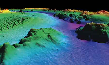
Bathymetry

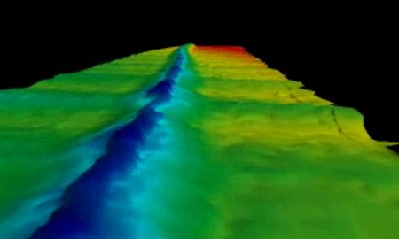
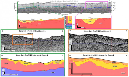
A geophysical survey is essential for surveying any areas that are culturally sensitive and are proposed drilling sites. High quality mapping and interpretations [including 3D], it also undertakes a wide range of tasks, including:  Bathymetric charting, side scan sonar, Sub-bottom profiler, Multibeam and Magnetometers we can deliver quality data of the seabed surface and shallow subsurface that can be used to effectively used in engineering and project planning.

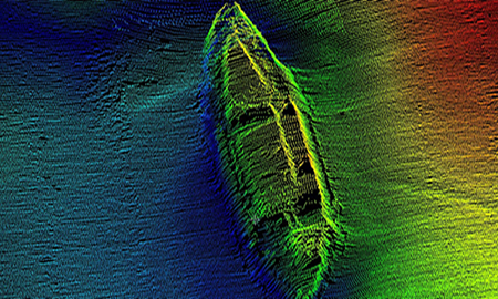
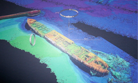
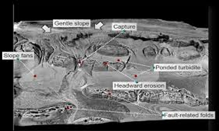
Location and detection of man-made artifacts including debris, shipwrecks, ordnance and sub-sea structures. Profiling of shallow geological features and structures to assist with engineering studies and facility design. Sea-floor and sub-surface geotechnical assessment. Location and detection of geo-hazards such as shallow gas, hydrates, unstable sea floors, active geological zones and potential shallow water flow-zones to enable exploration drilling, facilities installation and production operations to be performed safely and efficiently.

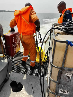
Survey-Operation-water

Cadastral Surveying & Property Boundaries

We deliver the legal measurement data you need to determine property boundaries or create new property by dividing or merging existing one. We measure and collect data for cemetery maps and maps of above-ground and underground utility cables and pipes. Maps are available in 2D and 3D and include GIS attributes and related information.

gps-mapping

Debris Clearance Surveys

Using subsea scanning sonar equipment and positioning to detect seabed surface debris and possible prior spud-can penetration sites can reduce the risk of damage to Jack-up MODU legs. This can save expensive time in problems with positioning these Jack-ups next to existing platforms and installations.

Sub-bottom-imagery
Debris-Undersea
Debris-Undersea-image
Sub-bottom
Debris-Undersea-Scan

Let's get in touch

Send us an email and We'll get back to you, as soon as possible.

Send Message

Social Handles

Find us here

  • SSEL
  • Sesco Survey and Engineering Ltd
  • No, 3 Nyokuru Close, off Estate Road, Rumuogba, Port Harcourt, River State.
  • +2348056652127 | +2348068483703
  • sescosurvey.eng@gmail.com
  • https://sescosurveyandengineeringltd.com

Our Services

  • Comprehensive Surveying Services
  • Geotechnical Survey
  • Construction Support Services
  • Geophysical/Hydrographic Survey Services

Services

environmental-monitoring

construction-support-services

© 2025 · sescosurveyandengineeringltd.com                                  Designed by: greeninnova.com

  • Home
  • FAQ
  • Contact
  • Request a Call